 Print
page Print
page Email
to friend Email
to friend

TODAY'S WEATHER
Overcast
81°F (28.3°C)
Latitude:
5 deg 40’N
Longitude: 86 deg 51.6’W
Wind Direction: SW
Wind Speed: 6 Knots
Sea State 3
Swell(s) Height: 2-4 Foot
Sea Temperature: 82°F (27.8°C)
Barometric Pressure: 1012.8 MB
Visibility: 10 Nautical Miles

Breakfast
Fresh fruits
Eggs
Bacon & Ham
Potatoes
Pancakes
Oatmeal
OJ in a Bucket
Lunch
Fresh salad
Fried shrimp
Fried cod fish
French fried steak potatoes
Peas & carrots
Dinner
Fresh salad
Roast chicken
Orange Roughy
Rice pilaf
Ovenbrown potatoes
Mixed vegetables
Strawberry shortcake
A Full Day at Sea
August 24, 2001
by Christina Reed
Six
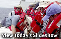
or more short blasts of the ship's whistle, listen up! One
more long blast: It's time to abandon ship - not for real,
but as part of the emergency drills we will be doing every
week while at sea. We grabbed our life jackets, hats and long-sleeved
shirts to protect us from the sun and made our way to the second
level, above the main deck, where the life rafts are stored.
A few souls got lost inside the ship. Good thing this was a
drill.
Today's transit to the Galápagos continued with much activity
onboard. Dock lines needed mending, the aft deck required a
safety line and the wire rope used to tow the camera sled and
dredge needed to be re-terminated with a new eye loop. Gene
Pillard, the Resident Technician, worked with Victor Barnhart,
the Bosun, and other members of the deck crew to get the ship
ready for our science work.
Uta Peckman, the shipboard multibeam data processor,
familiarized us with watch-standing procedures during bathymetric
surveys. Attached to the bottom of the ship's hull, the multibeam
sonar fires sound waves down towards the seafloor in 191 different
directions - like a flashlight with a broad beam. The sound waves travel
out to either side giving a swath that is as wide as about four
times the depth of the water below the ship. Inside the computer
lab we monitor the profile of the seafloor and map the bathymetry
as the ship cruises along at 12 knots.
"Making maps of the seafloor will be a big part of the work ahead of us as we
survey the submarine sides of the western Galápagos volcanoes," says Dan
Fornari. At the science meeting this morning, Mark, Dennis and Dan explained
that the detailed sonar maps we will make during the cruise are key to deciding
where we will sample the seafloor using the dredge.
At noon today we briefly caught sight of land
as we passed by Cocos Island to our starboard (that's the right
side of the ship). First mapped in 1541, the island was once
a favorite of passing pirates, sailors and whalers as the canopy
hosts fresh coconuts and catches more than 6 meters or about
19 feet of annual rainfall a year.
We plan on arriving tomorrow evening at the
northeastern edge of the Galpagos platform. There we will test
out the sonar systems and begin our research.
[Back to top]
|
