| Daily Updates: May
2003 |
| S | M | T | W | T | F | S |
| |
|
|
|
1 |
2 |
3 |
| 4 |
5 |
6 |
7 |
8 |
9 |
10 |
| 11 |
12 |
13 |
14 |
15 |
16 |
17 |
| 18 |
19 |
20 |
21 |
22 |
23 |
24 |
| 25 |
26 |
27 |
28 |
29 |
30 |
31 |
| Daily Updates: June
2003 |
| S |
M |
T |
W |
T |
F |
S |
| 1 |
2 |
3 |
4 |
5 |
6 |
7 |
| 8 |
9 |
10 |
11 |
12 |
13 |
14 |
| 15 |
16 |
17 |
18 |
19 |
20 |
21 |
| 22 |
23 |
24 |
25 |
26 |
27 |
28 |
| 29 |
30 |
|
|
|
|
|

TODAY'S WEATHER
Cloudy, Light Rain
70°F (21.1°C)
Latitude: 34° 54'N
Longitude: 62° 34'W
Wind Direction: SSW
Wind Speed: 23 Knots
Sea State: 4
Sea Temperature: 71°F (21.7°C)
Swell(s) Height: 9 Foot
Barometric Pressure: 1017.0 MB
Visibility: 6-8 Nautical Miles

BREAKFAST
Oatmeal
Grilled Canadian bacon and Spam
Homefries
Scrambled eggs
Buttermilk pancakes with real maple syrup
Grilled bagel with cream cheese and smoked salmon
Cranberry-orange walnut muffins
LUNCH
Tomato soup
Baked chicken quarters
Tater tot potatoes
Beef stir fry
Steamed rice
Asparagus/Swiss cheese quiche
Candy bars
DINNER
Roast pork loin with pan gravy
Pasta with Burgundy mushroom sauce
Cajun blackened vegetables
Smoked rice pilaf
Homemade garlic and herb bread
Homemade butterscotch oatmeal crisps
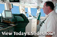
Ever Closer
May 27, 2003
By Joe Appel
On our first full day on the ocean, we encountered
somewhat smoother seas, and anticipation mounted as we drew closer
to the seamounts
In fact, we sailed right over one of them, Muir. Muir Seamount is almost 60 miles
long. It took us about six hours to pass over the two-mile-high mountain, whose
summit lies 1,350 meters below the surface of the ocean.
Though we’re not set to arrive at the
main seamounts until tomorrow morning, we’re already gathering
important pieces of information.
Seabeam uses sound waves to tell us about the contours of the sea floor and show
us the hills, mountains and valleys. Devices called transducers in the hull of
the ship send a swath of sound waves down to the seafloor. The sound bounces
off the seafloor and returns to the ship. The time taken for the sound to travel
through the ocean and back is then used to calculate the depth of the ocean,
which is the distance to the seafloor.
SeaBeam can measure the depth of the seafloor from 120 different spots in 10-15
seconds while traveling at speeds of over 10 knots. In this way, we are making
maps of the seafloor that will be invaluable when we start the hunt for corals
in earnest.
The ship’s gravimeter measures the Earth’s gravity every second. This
sensitive instrument allows us to see very small changes in Earth’s gravity
that are caused by different types and thickness of seafloor rocks. For example,
the force of gravity is slightly greater over an area of very dense rock at the
seafloor than over an area where there is a thick layer of less dense sediments.
So we can use these measurements to learn about the structure of the Earth’s
crust and the distribution of different rock types.
Then, there’s Maggie. That’s the affectionate name for a recording
device that can measure minute changes in the Earth’s magnetic field. It
is towed on a cable two boats’ lengths behind RV Atlantis. (Any
closer and the magnetic properties of the ship’s hull would taint the data.)
Every second or two, Maggie makes a measurement of Earth’s magnetic field.
In this way, we can find out how magnetic the rocks on the seafloor are.
Around midnight, we’ll be close enough to Manning Seamount to be able to
start surveying and mapping it. Who’d have thought listening for echoes
could be so valuable? But then, in the midst of a silent and seemingly endless
ocean, echoes are often all we’ve got.
[Back to top]
|
