|
|
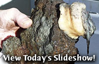
TODAY'S WEATHER April 24, 2001 By Amy Nevala Geologists Dan Fornari and Susan Humphris will spend a sleepless night collecting rocks from what appears to be a large seafloor volcano on the axis of the Central Indian Ridge, located about 40 nautical miles south of the Edmond field. Pulling their dredges from the Indian Ocean, they will look for fresh
basalt, a glassy black rock that forms when hot volcanic lava
hits icy seawater. The glassy basalt is a sign that the volcano
has been recently active. Our bathymetric maps show that this volcano is 20 miles long and 10 miles wide, with an elevation of 4,264 feet (1300 meters) -- about a third of the height of Mount Rainier in Washington state. No other features of this type exist within hundreds of miles of our location on the Central Indian Ridge. “Studying this volcano gives us more clues about how the mid-ocean ridge works,” said Dan. Volcanoes form along Earth’s sixteen large and several small plates, which “float” on a partially molten layer below them. The plates’ movement and interaction is called plate tectonics. Periodically the plate boundaries pull apart, collide or slide past or beneath one another, triggering dramatic forces, such as earthquakes and volcanic eruptions. We decided to head to the volcano tonight after ROV Jason’s depth sensor stopped working while collecting mussels and other vent animals at the Edmond field. “It’s impossible to know where we are in depth with respect to Medea without it,” said ROV Jason’s Chief Pilot Will Sellers. It also limits our ability to collect samples or make close seafloor observations. Medea is Jason’s teammate. It always hovers about 15 to 20 meters above Jason, absorbing the movements from the ship. Medea and Jason are connected by a 30-meter cable and need to maintain close contact for efficient operations on the seafloor. “When you think about it, it’s amazing that this maze of wires and sensors we call ROV Jason, connected to the ship by a 10 kilometer fiber optic cable, works at all,” said Dan. “We take technology for granted these days, and for the past month we’ve been used to going to work on the bottom of the ocean nearly every day as if it was routine.” As a matter of fact, it is routine. Almost every day of the year, ROV Jason, Alvin or deep submergence vehicles operated by three other nations worldwide are exploring the seafloor. For U.S. scientists, going to the depths of the ocean
using Jason or in Alvin is
routine, thanks to the innovative engineering and operational expertise
of the National Deep Submergence Facility at Woods Hole Oceanographic
Institution. They have been providing deep submergence capabilities
for scientists and engineers for over 30 years.
|
|||||||||||||||||||||||||||||||||||||||||||||||||||||||||||||||||||||||||||||||||||||||||||||||||||||||||||||||||
Mailing List | Feedback | Glossary | For Teachers | About Us | Contact
© 2010 Dive and Discover™. Dive and Discover™ is a registered trademark of
Woods
Hole Oceanographic Institution


