|
|
|
|
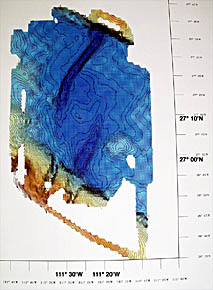
This is a bathymetric map of the Guaymas Basin. The linear dark-blue areas in the middle of the map represent two prominent troughs. These are the spreading axes of the mid-ocean ridge. The troughs are about 2,000 meters deep.
|
|
© 2010 Dive and Discover™. Dive and Discover™ is a registered trademark of
Woods
Hole Oceanographic Institution
