Click on the maps below for a enlarged version.
|
Seafloor
topography in the eastern Pacific Ocean. (Map by Paul Johnson, U.
of Hawaii-HMRG, using satellite altimetry data) |
|
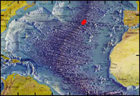
Project
FAMOUS explored the Mid-Atlantic Ridge crest between 36°N and
37°N. (Physiographic map of the North Atlantic Ocean by Bruce
C. Heezen and Marie Tharp) |
|
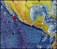
Weeks after the 1979 Galápagos dives, Alvin headed north
to explore the East Pacific Rise at 21°N, where the first black
smokers were discovered. (Physiographic map by Bruce C. Heezen and
Marie Tharp) |

|
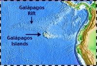
Multibeam
bathymetry data along the axis of the Galápagos Rift showing
the area at 86°W where hydrothermal vents were discovered in 1977,
and the area near 89°W that will be explored on a cruise in 2002.
(Multibeam data from Canales et al., J. Geophys. Res., 102, 27,341-27,354,
1997) |
|
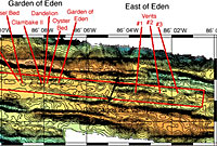
Multibeam
bathymetry of the Galápagos Rift showing sites of hydrothermal
activity and vent biological communities. Red box outlines the area
of known low-temperature venting and animal communities. (Multibeam
data from Canales et al., J. Geophys. Res., 102, 27,341-27,354,
1997)
|
|