Daily Updates: May 2004 |
| S | M | T | W | T | F | S |
| |
|
|
|
|
|
1 |
| 2 |
3 |
4 |
5 |
6 |
7 |
8 |
| 9 |
10 |
11 |
12 |
13 |
14 |
15 |
| 16 |
17 |
18 |
19 |
20 |
21 |
22 |
| 23 |
24 |
25 |
26 |
27 |
28 |
29 |
| 30 |
31 |
|
|
|
|
|
| Daily Updates: June 2004 |
| S |
M |
T |
W |
T |
F |
S |
| |
|
1 |
2 |
3 |
4 |
5 |
| 6 |
7 | 8 |
9 |
10 |
11 |
12 |
| 13 |
14 |
15 |
16 |
17 |
18 |
19 |
| 20 |
21 |
22 |
23 |
24 |
25 |
26 |
| 27 |
28 |
29 |
30 |
31 |
|
|

TODAY'S WEATHER
Partly Cloudy
64°F (17.8°C)
Latitude: 47° 58'N
Longitude: 129° 05'W
Wind Direction: W
Wind Speed: 18 Knots
Sea State: 4
Swell(s) Height: 8 Foot
Sea Temperature: 55°F (12.8°C)
Barometric Pressure: 1017.5 MB
Visibility: 12 Nautical Miles

BREAKFAST
Scrambled eggs
French toast
Oatmeal
Sausage
English muffins
Home fries
Lemon cheesecake muffins
LUNCH
Shepherd’s pie
Pasta primavera
Pastrami and swiss on rye
Tomato soup
Rice
Salad bar
Chocolate chip cookies
DINNER
BBQ ribs
Tator tots
Fish fillets
Fried rice
Mixed veggies
Cauliflower with cheese
Biscuits
Ice cream
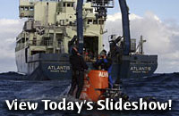
Mapping Main Endeavour and Mothra
May 31, 2004
By Amy Nevala
Imagine driving a small car at night through an unfamiliar
mountain range, equipped with only a flashlight to guide your way among
the valleys and peaks. Without seafloor maps, flying in the research submersible
Alvin at hydrothermal vent fields on the Endeavour Segment would be just as tricky.
A major objective of this expedition is to create high-quality maps of the
Main Endeavour and Mothra hydrothermal vent fields. Maps help researchers
plan their explorations of the seafloor by pinpointing specific chimneys,
fissures, and valleys of interest. They also ensure that researchers aren’t
flying aimlessly among these complex seafloor structures, which would be
frustrating, as well as a waste of time and money.
To explore the Main Endeavour vent field, scientists and
Alvin pilots have been using maps developed by Marine Geologist
Veronique Robigou at the University of Washington during previous Alvin
dives to the field. Scientists on this cruise are developing even more
detailed maps using a near-bottom, high-frequency scanning sonar.
This measurement can "see" details
on the seafloor smaller than 3 feet (1 meter), which is many times better
than the sonar collected from the surface ship. Maps made from Alvinmeasurements are sharper and clearer because they are made closer to
the bottom—50 feet (15 meters) off the bottom, compared to the ship
at more than 1 mile (1.6 kilometers) above the bottom—and because the
Alvin measurements are made at a higher frequency, 675 kilohertz compared
to 12 kilohertz from the ship.
Today researchers in Alvin dove to a northern portion of the
Main Endeavour field called Hulk, named for its tall, tree-like
black smoker
chimneys. Researchers had mounted the Imagenex system under
the rear of the sub, and the sub flew slow, tight loops about 50 feet
(15 meters) above the field. The sonar swept back and forth in continuous
arcs, sending pulses of sound that bounced from the chimneys and other
features back to the sonar system. The time for each sound pulse to return
to the system is used to calculate the depth and location of the seafloor
features.
STITCHING TOGETHER A MAP
Hundreds of thousands of these data were collected in a data logger on
the sub, and when Alvin returned to Atlantis about 4 p.m., Technician
Dave Sims downloaded the information to the ship’s computers. Tonight
Geological Oceanographer Vicki Lynn Ferrini will begin processing the
data, which she will sort and compile to begin creating seafloor maps.
The data are also valuable to Deb Glickson, a doctoral student at the
University of Washington, who uses the maps to better understand the geologic
processes that created the Main Endeavour and Mothra vent fields.
In the days ahead we will return to the Mothra field, which is still largely
unexplored since its discovery in 1996. Researchers know it as the largest
field on the Endeavour Segment, stretching the length of six football
fields, nearly a half mile. So far on this expedition, they have half
of the field mapped, and with one more dive, they should have enough data
to nearly complete the job.
|
